
Flintlocks, Liquid Gold, and Indian Wars
Retracing the Butterfield Overland Mail Route through New Mexico
By Dr. Jon Solberg
I keyed the mic and the radio crackled: “Donna Ana County Airport, this is Cessnatriple five delta-delta, departing runway two eight.”
Jake Quinones, owner of New Mexico Backroads guiding service, gave a confident two-thumbs up from the passenger’s seat. I advanced the throttle and we were airborne, the runway’s centerline slipping below us and into darkness. Moments later, the first morning sunlight peaked over the horizon and the green banks of the Rio Grande River Valley lay in contrast to the brown desert which stretched to either side. Our flight plan was simple: fly low and slow over New Mexico and look for the Butterfield Trail.
One hundred and fifty years previously, Waterman L. Ormsby and William Tallack traveled separately as passengers aboard the Butterfield Overland Mail Company’s (OMC) stagecoach route. While most of the passengers tried to forget the 23 days and nights of tortuous travel, Tallack and Ormsby kept their eyes peeled and pens employed, journaling daily about the life and landscape on the American frontier as it passed by just outside their stagecoach window.
We had used Tallack’s and Ormsby’s journals to draw a jagged sharpie line on my aviation map. From 2,500 feet above ground level, the sharpie line matched an obvious zig-zag on the ground, from one mountain pass, valley, and mesa to the next. But the question that was begging at both our minds was “could we drive the Butterfield?” Could the sights, sounds, and smells of the American Frontier, as experienced by Tallack and Ormsby in the 1850s, still be experienced by the modern overland traveler?
There was only one way to answer that question, and fortunately for us, our morning flight was only the start of our next New Mexico backroads adventure. After parking the plane back in the hanger, I turned to Jake and with a Sharpie-marked roadmap in hand, asked him point blank:
“Do you suppose we’ll actually find the Butterfield?”
Jake leaned out his Jeep’s window and once again answered with a confident two thumbs up, and with that, we set off to drive the most historic stagecoach route in history.
A Brief History Lesson

Prior to the Butterfield Mail Route, correspondence between routes took an arduous journey through Panama.
By the mid 1850s, the United States had acquired all land between the Atlantic and Pacific oceans. The coasts were booming, but the middle section remained uncharted and uncivilized. Anything traveling between the coasts took a steamer to and from Panama and crossed the Isthmus by mule train. Overland routes existed, but they were plagued by Indian attacks, bad weather, equipment failures, and the absence of reliable water. In 1858 the U.S. Post Office awarded a new mail contract to express and transportation guru John Butterfield. After forming the Overland Mail Company (OMC) and acquiring enough coaches, livestock, and employees, he enthusiastically instructed his employees, “Remember boys, nothing on God’s earth must stop the United States mail!”
Passengers and mailbags rode cramped in the same compartments. Stagecoaches were pulled by fast and efficient horses where the roads were civilized. Heavy sub-frames supported ornate paneling, comfy seats, and reinforced roofs which carried extra luggage. West of the Pecos River in Texas, however, where the going got tough, mules pulled specialized Celerity wagons which weighed half as much as a stagecoach. Wider, smaller wheels enhanced flotation and kept the center of gravity low. A thin canvas top saved weight and facilitated airflow to passengers. The horses and mules were switched about every 20 miles in a flurry of dust that would rival a NASCAR pit crew. All in all, the Butterfield OMC carried the mail across 2,795 of the roughest frontier miles imaginable. During the 900 days it operated, it was never late.
Salopek’s Orchard
After our scouting flight, we followed the OMC north from El Paso on New Mexico’s Highway 28, a quaint two-lane that skirts the Rio Grande River as it weaves between orchards and horse farms. Our first stop was the home of Howard and Ginger Ness. They live in an exquisitely preserved adobe home which has been listed on the National Register of Historic Places. The monster trees in their yard are probably one hundred and fifty years old. At 86 years old, Howard is an amateur historian and archaeologist, and he’s been known to “seed” his yard with replica arrowheads to spark local children’s interest in history. Today, he had arranged for us to meet with Gary Kuhn and Robert Otero, pecan farmers who work with Salopek 6U Farms, an internationally recognized pecan farm. Over coffee in Howard’s “Indiana Jones-ish living room,” it became readily apparent that these gentlemen were not only farmers, but also educated and articulate historians. Gary reached into a briefcase and produced a hard covered book.
“Forgotten Fortress, Fort Millard Fillmore and Antebellum New Mexico,” I read the title aloud. “Fort Fillmore was a stop on the Butterfield, wasn’t it?” I pointed out the window and towards a field of towering pecan trees.
“It was, but it’s on private land now: Greg Salopek’s land,” he replied. “Greg Salopek is a hell of a good man, and he’s gone to a great deal of personal effort to preserve what’s left of the fort. If you’ve got time, we’ll take you there.” And so, after the last drop of coffee was consumed, we set off in a small dusty convoy which passed through endless rows of perfectly spaced pecan trees. Eventually we came to a clearing, a military parade field right in the middle of an orchard. Several sprinklers clicked in unison and a small rainbow was visible over the field and through the mist.
We stood leaning against the vehicles as Mr. Kuhn told us of Fort Fillmore and how it was established in the 1850s on the banks of the Rio Grande to protect settlers and travelers. For a time, it was a stop on the OMC. One year after Tallack’s coach passed by, the fort’s adobe walls were torched by a retreating Union Army, a staunch reminder of the turmoil that divided our country at the height of the Butterfield and on the eve of the Civil War.
Mr. Kuhn pointed out a 10-yard by 10-yard patch of red, mud brick tiles, and I bent over to run my fingers across them.
“Probably the floor of the old officers’ quarters,” he said.
Despite the Salopek’s efforts to turn the site over to any government agency willing to maintain it, there were no takers. The site could have been easily plowed into more pecan trees but John Salopek, himself a former military officer and prisoner of war, felt compelled to preserve the site, and as Gary explained, the Salopek family deserves all the credit for what’s left: the remaining tile floor, a stone monument and flag pole, and the fort’s cemetary and parade field, which has served as a site for military reenactments and even an official military ceremony or two.
To be totally honest though, there’s not much there: no visitor center, no interpretive trail, and no Bluetooth audio tour. What is readily abundant however, is the spirit of the men who were stationed there and that of John Salopek, who chose to preserve it. As I ran my finger across those red, dusty tiles, I wondered if they had been graced by the shoe leather of a Union or Confederate soldier, or a fur trader, or a Butterfield employee, or perhaps Tallack himself. As we shook hands and parted ways, Mr. Kuhn sent us packing with a bag of the tastiest, freshest pecans Mother Nature has ever served, and as we drove out of the orchard, we were glad to know that the spirit of the OMC and the Old West was alive and well in Salopek’s orchard.
Wild Bill’s Arsenal
Twenty miles north of Fort Fillmore, near modern day Las Cruces, New Meixco, OMC passengers could breathe a sigh of relief as they arrived in Mesilla, the halfway point and largest settlement on the route. To the wearied passengers, the town square offered amenities not available elsewhere: fresh fruits and vegetables, a saloon or two, perhaps a brothel, and an extended stop for those wishing to rest before continuing their journey.
After Mesilla, Ormsby’s coach switched once again to “those interminable mules” and prepared itself for a “dreary ride of fifty-two miles for Cooke’s spring. This is the commencement of that series of deserts without water extending from the Rio Grande to the Gila—one[CC4] of the most tedious portions of the route.” As the mules strained to pull the coaches up the long and grueling grade, passengers were forced to exit and walk…ladies too. At the top was, just as Tallack describd, a “broad and level plain extending as far away as the eye could reach. At our backs were the ranges of the Oregon [Organ] Mountains, the debris of the Rocky Mountains, forming the eastern border of the Messilla [Mesilla] Valley. In front we could just see in the distance Cooke’s Peak, rising from the plain in bold prominence from among the surrounding hills.” Jake and I stopped our Jeeps at the top of the grade, waited for a dust devil to swirl past, then stepped outside to scan the horizon. There to the east was the Organ Mountains and the steep grade leading back to Mesilla. To the west was Cooke’s Peak, bold and well outlined on the horizon. It was as if Ormsby had looked out the windows of our Jeeps and penned his very words.
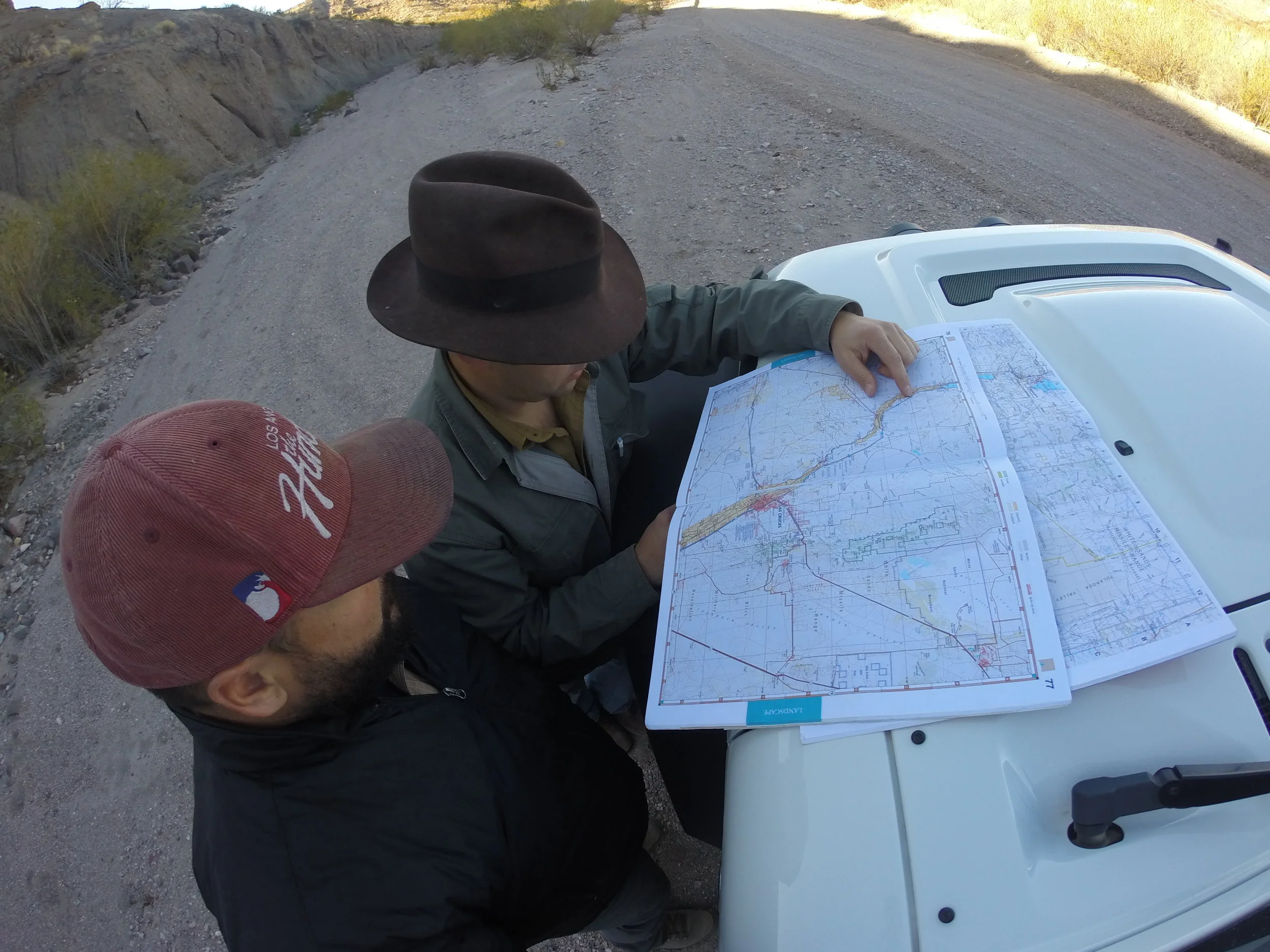
Jon and Jake stopping to check the map.
To our west lay an expansive desert plateau overlaid with a maze work of gravel ranch roads and endless sage brush. Eventually we turned off on an approach and I followed Jake down a two-track trail and into an abandoned gravel pit. At the bottom sat a white, vintage 4Runner. As we pulled up and killed the engines, out stepped a grizzled creature, clad head to toe in buckskin and appearing like one of the station keepers described by Tallack: “armed to the teeth with revolvers and bowie knives.” Low and behold, it was our friend Bill Luther from the El Paso Archaeological Society. Bill had agreed to meet us in full rendezvous attire, complete with all his buck-skinning paraphernalia and OMC-era black-powder weaponry. He dropped his tailgate to reveal a full arsenal. First came a flintlock 20-gauge smooth bore. He explained how flintlocks were still in circulation at the time of the OMC, as the lack of a reliable supply chain made the newly invented percussion cap technology quite difficult to acquire on the frontier. With this weapon, however, a well- trained frontiersman could load and shoot up to three times a minute, choosing between either a round ball or a pre-wrapped bundle of birdshot, depending on the size and distance of the game (or enemy).
Next, it was on to his 50-caliber musket, which he demonstrated was accurate out to nearly100 yards, even with open sights. Then came an original rolling block Remington from the 1860s, one of the first cartridge rifles ever produced: a huge technological advance over the miss-hap prone, open flash pan of the flintlock. It was recovered from a cave deep in the mountains of Mexico, traded to a local archaeologist, and then acquired by Bill, who refurbished it and eagerly showed off its matching serial numbers. Soon, it was on to the pistols. The remainder of the afternoon continued in like fashion: Bill would produce another weapon, describe in detail its development and utility, give a demonstration, and then insist we shoot it ourselves until our shoulders and hands were sore from the recoil.
Eventually the shooting ceased and the smell of black powder was the only evidence of our history lesson on frontier firearms. I sat on Bill’s tailgate and pulled a history book from my field bag, reading aloud to the group about Eugene Van Patten, Colonel in the New Mexico Militia.[CC5] In his memoirs, he recounted the fear of Indian attack was so great during the time of the OMC that if an approaching wagon’s trumpet blast wasn’t returned with a similar blast from the station keeper, the wagon would circle wide and assume the station had been overrun with Indians. He also described an Apache ambush on Butterfield employees in 1860 as they traveled through a narrow pass near Cooke’s Peak. The Apache shot the lead mule, rendering the coach able to turn around. The Indians had the high ground and sent a constant volley of arrows towards the coach until the OMC employees had nearly exhausted their ammunition. When the last mule had finally been shot and two of the passengers wounded, the Butterfield employees [CC6] grabbed the remaining ammo and a canteen of water and tried to escape. Twelve miles west, a caravan of traders had broken camp and sent ahead a group of scouts that heard the gunfire and came upon the arrow-ridden coach. They returned to their group, circled the wagons, and dispatched a rescue party that finally outmaneuvered the Indians and drove them off.
It was now dark, and a nearby soap tree yucca bush was silhouetted by the moon such that its spiny leaves looked like the headdress of an approaching Indian warrior. Jake pointed out that our ammunition supply was exhausted, and with the ambush story still lingering in the air, I suggested we formulate a plan in case this was to be our last stand. Bill reached into his breast pocket and produced a stash of cigars, suggesting that for historical accuracy, we should either send smoke signals or offer a peace pipe. Neither Jake nor I could argue with that, and so we all just stood there and smoked in silence, squinting into the darkness as if trying to convince our eyes that that yucca bush hadn’t moved just a little bit closer and now become two instead of one.
Cooke’s Peak
Neither Tallack nor Ormsby wrote much of the area surrounding Cooke’s Peak, despite its 8,408-foot summit dominating the landscape for a 100 miles in all directions. The mountain, canyon, and nearby spring are all named for Lt. Colonel Philip St. George Cooke, commander of the Mormon Battalion which blazed the trail here 10 years before the OMC. Cooke’s Spring is the only supply of fresh water between Mesilla and the Mimbres River, and its cool, clear water is the desert’s most valuable commodity. The area surrounding[CC7] Cooke’s Canyon was known as “the gauntlet of death,” and it’s unknown exactly how many people died here. Fort Cummings was eventually established nearby to provide protection for the mail routes, [CC8] but by 1867 the road was so littered with sun-bleached skeletons that a group of soldiers was finally dispatched to remove the bones.
Tallack did comment on the remarkable speed they made here, making 14 miles in only 61 minutes, a remarkable pace achieved through equal parts quality road and a healthy fear of Apache ambush. Here also, according to Tallack, their coach was boarded briefly by a mysterious individual from Mimbres whose only comments were on the “disorganized state of society in these regions” and how “no one’s life is safe here for two hours; everyone goes about with arms and seven out of every eight men have at some time killed one or more persons.” Ormsby’s journals didn’t reference the area either, perhaps because he gripped his pistol instead of his pencil. On or about midnight, Friday October 1st[CC9] , 1858, Ormsby’s coach stopped in the darkness near Cooke’s Peak, listening[CC10] intently to the out-of-place sounds of strange men and horses coming from around the next corner. Weapons were cocked and readied as the occupants steeled themselves for what they feared may be their final moments. Imagine the sigh of relief when they realized the strange sounds were made by the second-ever, eastbound OMC coach, and not those of the Apache preparing to attack.
We approached the peak in the morning from the east. After several hours of wrong turns that led us farther up the mountainside on switchback roads, we backtracked and finally identified the unmarked road leading to Cooke’s Spring, the ruins of the OMC building, and what remains of Fort Cummings. The dilapidated fort walls are in a nearly degraded condition and tragically, the ground is picked clean of artifacts. The Hyatt family ranch owns many of the remaining adobe structures and the actual spring itself. [CC11] They are gracious enough to cooperate with the Bureau of Land Management to keep this area open, and our hats are tipped to them for making this site open to the public. Please, leave their cattle alone, do not touch the crumbling walls, and leave everything just as you found it.
Cowboys, Indians, and Water
West of Cooke’s Spring we drove by Soldier’s Farewell. Some of the first heliographs (large signaling mirrors) were used here by the military, and in one instance, a scouting party for the Mormon Battalion signaled by heliograph that they were preparing to drive hostile Indians from a nearby spring, in order to gain access to the much needed water. The scouting party was soon killed in its entirety, and the name Soldier’s Farewellwas given to the hill where the last heliograph message was sent. Nothing remains of the stations here, possibly because not much ever existed.
Near Soldier’s Farewell, we stopped to investigate a large water tank. One squeaky turn of the spigot let forth a steady stream of clear, liquid gold, turning a small patch of red, dusty earth, briefly into mud. Not long after turning the spigot, a flatbed ranch truck pulled up and boldly parked between the water tank and us. The face of its loan driver was silhouetted against the windshield by a large cowboy hat. The door squeaked open, and a cowboy emerged. He spoke rapidly in Spanglish through a scraggily handlebar moustache. I didn’t understand the conversation, but it seemed intense. As Jake and the vaqueroconversed, tensions gradually eased and laughter permeated the air. For the life of him, he couldn’t understand why anyone would venture out here “for a good time.” We asked about his purpose in the middle of no-where, assuming it was to guard the land, feed the cattle, and mend the fences. We were wrong.
“No, Senior. No agua, no vaccas,” the vaqueroreplied.
The cowboy’s job was to protect the water, which in turn kept the cattle alive and nearly obviated the need for fences, as the cattle never strayed far from the water.Control the water, and you control the land.Now that’s a history lesson that hasn’t changed in a very, very long time.
Disappointment at Stein’s Peak
From Soldier’s Farewell to the Arizona border, Ormsby’s hand loosened up just enough to pen some more words: “We left Soldier’s Farewell on [October 1st, 1858] at 10:15 am, having to go forty-two miles to Stein’s Peak without water, across a rolling plain with a smooth, hard road, part of which I must credit to Col. Leach. We had learned on our way that the station at Stein’s Peak was a favorite camping ground for the Apache Indians, and that but a few days before a band of two hundred and fifty, headed by Chief Mongas [Mangas], had gone to the station and demanded the gift of twenty sacks of corn, telling the men they had ‘better hurry it up d----d quick.’We met with no adventure on the road but a few shots at Key-o-tahs [coyotes], and seeing a couple of harmless Indians but in view of what had happened it may be judged that we were a little anxious on approaching the station, for if instead of the corral we should see a heap of smoking ruins and an Indian camp…” [CC12]
Our final leg to Stein’s Peak stretched west from Lordsburg, New Mexico, and across the Animas Valley Alkali Flats. But when numerous oilfield and railroad gates blocked our access, we were forced to take 15 miles of I-10 instead. Running out of daylight, we pitched camp one last time in the shadow of the Peloncillo Mountains near Volcano Mine Road. After gathering an armload of downed mesquite, we had a fire roaring as two giant rib eye steaks and a handful of New Mexico chilies sizzled in a cast iron pan over the open flames.
Although the meal was fantastic, the conversation seemed distant as we casually reflected on our retrace of the OMC and our planned arrival at Stein’s Peak the next morning. The site was rumored to be the best-preserved OMC station in New Mexico, but it was also home to multiple atrocities delivered by our own government to the Native Americans. On one occasion a group of Chiricahua Indians were forced to flee their reservation at San Carlos. Their religion, however, required them to stop near Stein’s Peak for a young maiden’s coming of age ceremony. The gala was interrupted when U.S. soldiers attacked; the Indian men were forced to fight as the women and children retreated. On another occasion, in July of 1858, nearby soldiers gave liquor to a band of Apache warriors. When the Apache had become so drunk they could no longer defend themselves, the soldiers murdered all 36 men, women, and children. As we’d stopped to read a bit of history at each important Butterfield stop, we were constantly reminded of the countless social injustices dealt in the name of Manifest Destiny.
These thoughts made for a poor night’s sleep, and the following morning neither of us had much of an appetite. Skipping breakfast we made our way up Doubtful Canyon, where the ruins became visible on a hillside south of the gravel road. We hiked across a small canyon to the adobe structure, illuminated by the orange morning light like a small fortress. It was in nearly perfect condition, with windows and doors intact; by far the most well-preserved site we’d seen. We rushed up the hillside only to be stopped 10 feet from the ruins by a four-strand, well maintained barbed-wire fence and a sign that read in bold letters “Private Property—Keep Out.” I looked around and there wasn’t another soul for what seemed like a hundred miles. I moved towards the fence but hesitated.
“We can’t go in,” Jake said firmly without making eye contact.
“I know,” I replied.
Initially, our conversation directed anger towards the land owner for keeping this piece of American history to himself. But then, we realized there wasn’t another man-made structure anywhere in sight. It was perfectly quiet, but it was hard not to hear the conductor’s trumpet blast and the hoof beats of mules as they strained to pull the squeaky coach up the hill. Those perfectly preserved, glowing adobe walls only added to the serenity of the place, and the barbed wire was now barely noticeable anyway. Surely, the scene would not have been the same if the walls had crumbled and the site been picked clean by looters looking to take a piece of the Butterfield for themselves.
But, we weretaking a piece of the Butterfield. After all, we had touched the same floor tiles paced by Union and possibly Confederate troops; we’d shot flintlock and percussion cap weapons until our shoulders were soar and our ammunition supplies exhausted; we’d prepared to make our last stand against an advancing party of soap tree Yucca bushes; we’d crossed paths with a true vaquero who confronted us to protect his cattle’s water, and we’d basked in the glowing sunlight alongside a stagecoach station which has remained undisturbed for nearly 150 years. What started for us as an idea formed around a campfire had morphed three years later into a simple question. “Could we drive the Butterfield Trail?” We’re happy to report that yes, the Butterfield Trail can be driven, but better yet, it can be touched, smelled, heard, and lived, if you’re willing to venture off the paved road in New Mexico.